A West Desert Bike to Board Odyssey
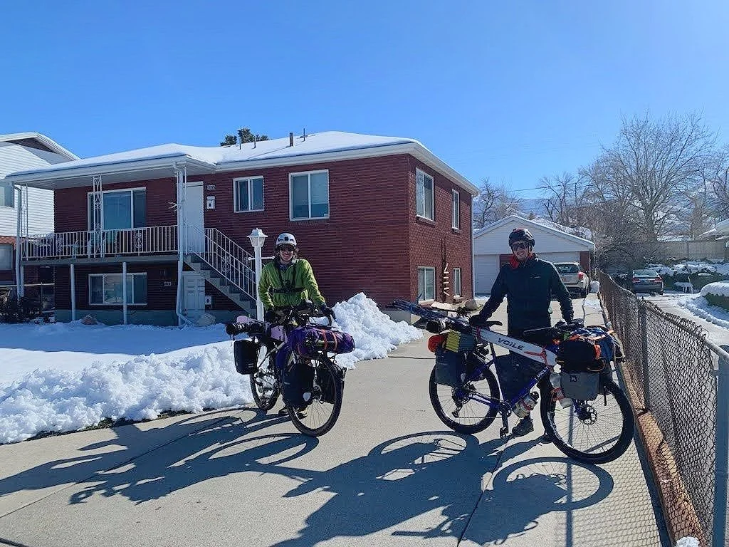
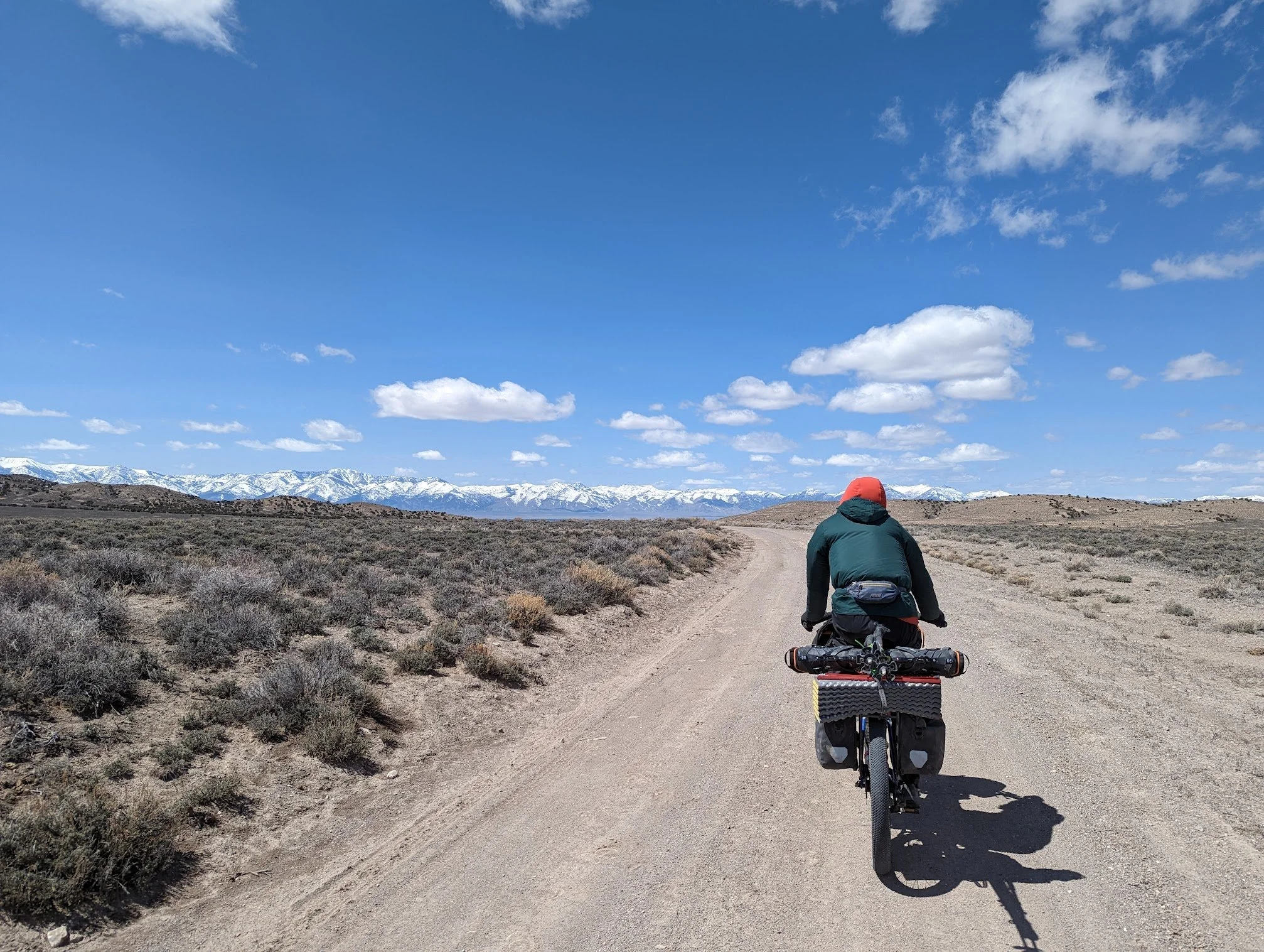
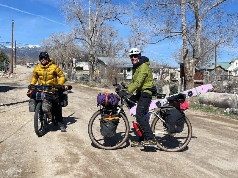
Missed the first train so had plenty of time for bike shotsIn early April of 2023, amidst the most epic winter the Salt Lake Valley had ever seen, my friend Ian and I packed up our bikes with my splitboard and his skis and headed west to some unknown-to-us mountains. On bikes that easily weighed over 100 pounds, we took 25 days to pedal 600 miles across deserted lake beds and skied 75 miles in remote island range mountains all the way to Great Basin National Park, where we reached our furthest and highest point before heading back home. Along the way, we encountered startling remoteness within inhospitable landscapes, kindred spirits in quaint places, and some spectacular desert scenes reserved for folks like us who are willing to venture beyond the beaten paths and slow things down. We found that our pedal-powered travel seemed to reveal landscapes at a speed that was easy to comprehend and gave us greater clarity in our decision-making process. We successfully executed all of the objectives we set out for and added some bonus turns and destinations along the way. It was the most rewarding adventure we’d ever done and we learned A TON along the way. I’m ready to strap my splitboard on my bike again, so I guess that means this trip was a smashing success…
Pre Trip
I had been wondering what lay behind the Oquirrh Mountains to the west of Salt Lake City ever since I started splitboarding a few years ago. Despite a record-breaking snow year in our home range of the Wasatch Mountains, this was my shot to finally get out. I have to give major credit to my friend, roommate, and adventure partner, Ian, for approaching me with this trip idea sometime in the fall of 2022. Ian is an altered beast, full of wonder a spirit for getting out there. Wayyy out there. And as crazy as this trip sounded, the same altered beast in me knew it would be our most grand adventure yet.
Backcountry Ski & Snowboard Routes: Utah - Mountaineers Booksgreasy Shop Rat ready to be a desert ratWe planned for months, scouring guidebooks, online resources, and personal connections to gain all the info we could. In the spring of 2022, we did a long bike tour through some tricky terrain in Southern Utah, so we were pretty confident in our bikepacking skills. Ian and I had been ski touring together for 3 seasons, so there was nobody I trusted my life with more than him when we got to remote mountain terrain. With a good idea of our bike and ski routes and some prior experience, we estimated roughly how long each leg of our journey would take. We prepared 24 days of food for ourselves ahead of time, packing 12 days out the gates to get to Baker, Nevada, where we shipped another 12 days of food and would use as the only reliable destination on our path. We both worked in ski shops so we tuned and waxed our shred sticks to the max, knowing that all that love would probably wear off after our first desert snow shred, and we were totally right.
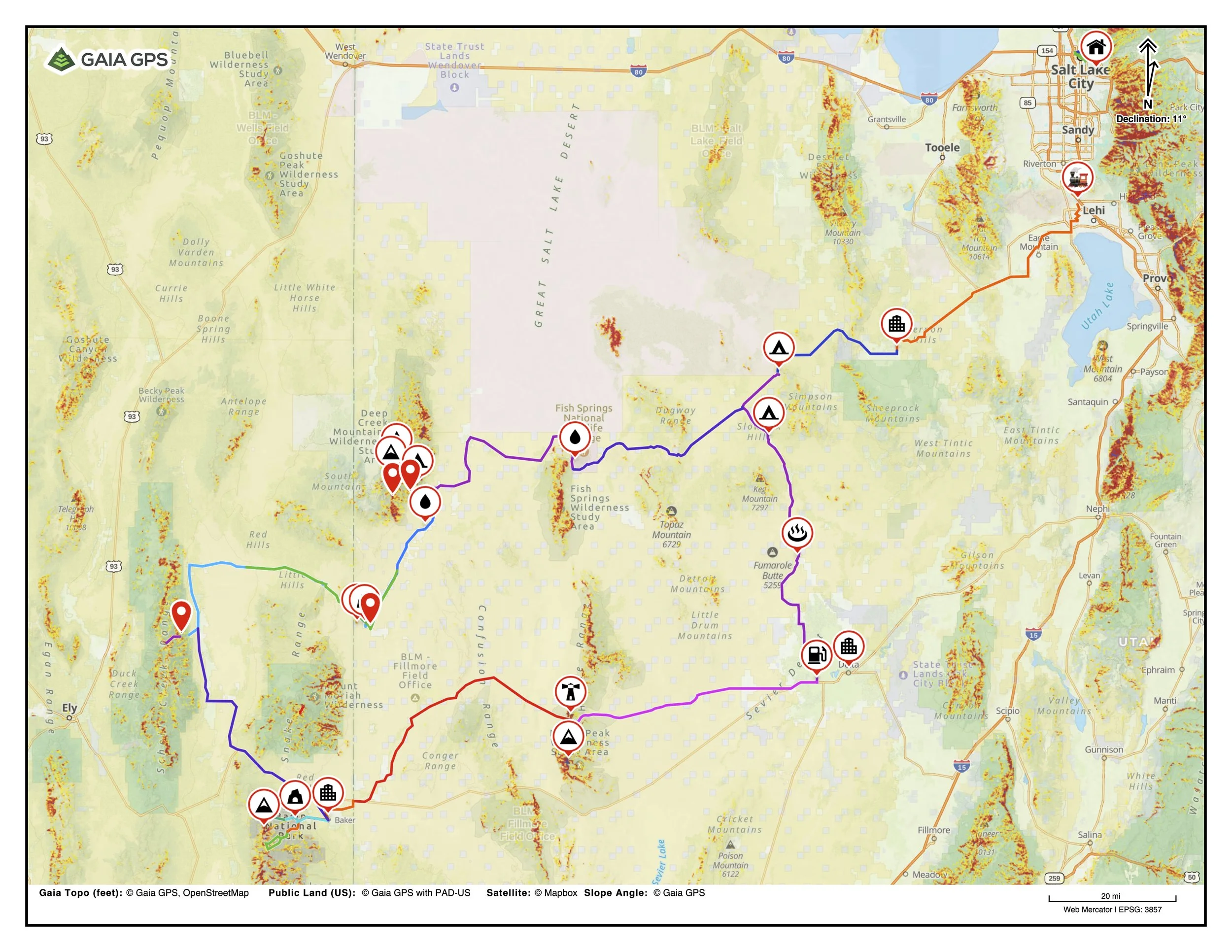
Our path consisted of 4 bike segments, 3 mountain ranges, and one town. A lot of our bike route was along the old Pony Express Route, and the mountains were all separate island ranges, floating above the Great Basin lake bed. The first leg was from Salt Lake City out to the Deep Creek Mountain range, where we dealt with intense warming conditions and got a wake-up call on how serious the ski missions were going to be. From the Deep Creeks, we would cross into Nevada to ski the Schell Creek Range. We found some good snow there and built our confidence before heading to the granddaddy peak of the trip, Wheeler Peak, in Great Basin National Park. The small town of Baker, NV lies at the east edge of the Park and is home to some lovely people who convinced us that since we had biked all the way there, we should stay and check out some other areas of the Park. They made a great point, so we went back into Great Basin NP and we’re glad we did. Then it was a snowless yet exciting slog back home to SLC where we were greeted and celebrated by nobody but each other and our bikes. Not even our cat.
Ready to roll, kinkade styleSLC → Deep Creeks
Headed wayyy out there, via Simpson Springs CGWith our jobs on hold, our goodbyes said, and bikes packed, all we had to do was wait for one more April snowstorm to fall and melt enough to ride our bikes out of this salty town. We first realized how heavy our bikes were as we swerved patches of snow on the Sugarhouse Park bike path as we left our house and headed downtown to catch a Frontrunner train to Lehi and really begin the long pedal. Riding that train would be the fastest we moved for another month or so.
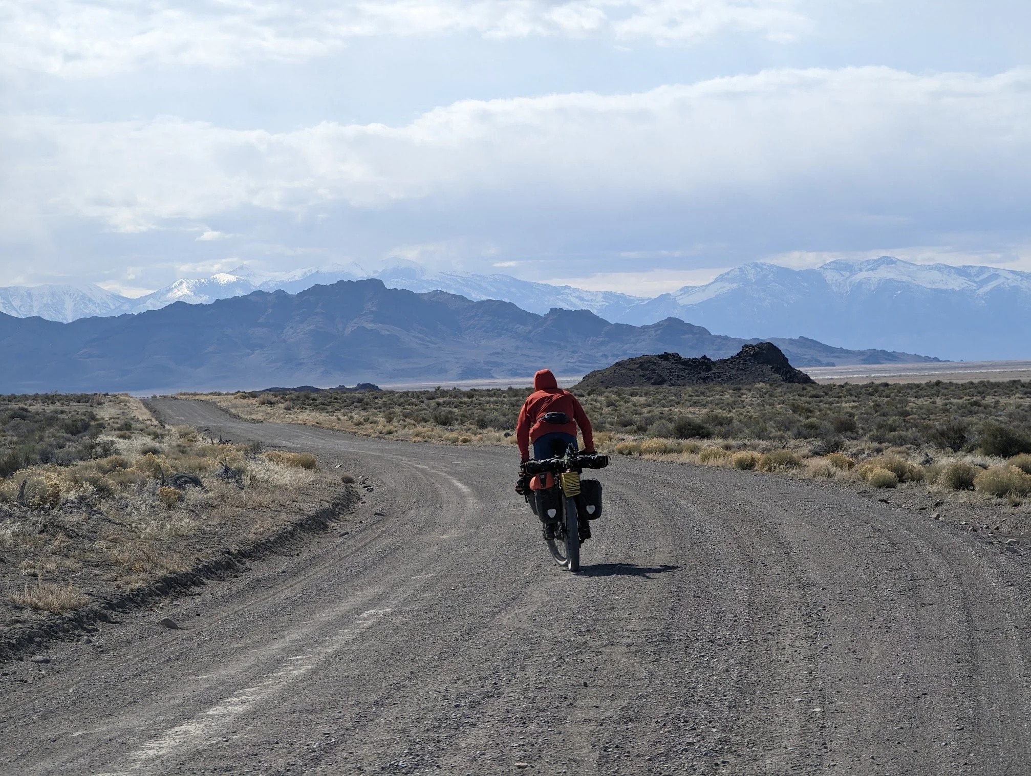
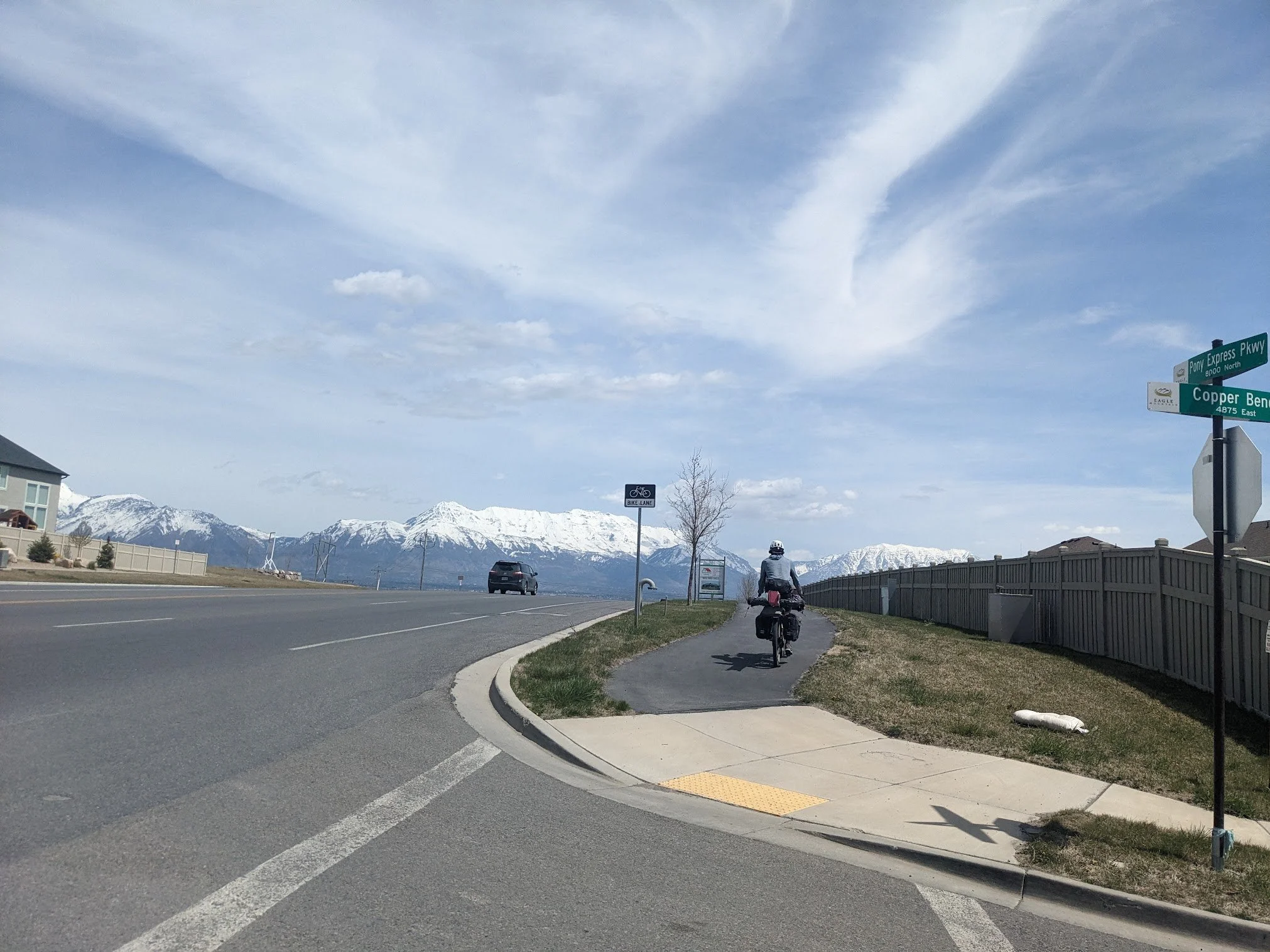
Camp 1. Ski poles work great as a bike stand in open desertOnce off the train in Lehi, we encountered what was probably the most dangerous part of our trip: biking through a world built entirely around cars. We rode along with busy traffic through broken bike lanes and cherished any glimpses of a bike path. Once in Eagle Mountain, we caught the old Pony Express Route which eventually turned to gravel, but not first without some highway hill climbs and dodging some mud pits before committing to dirt for the next week or so. At about 40 miles into our day, we pulled off to camp in an open plain. As we pitched our tent we were in awe of a 360 view of the Stansberry Mountains, The Ohquirres, Mt Timpanogos, Mt Nebo, and the Sheeprock Mountains, all blanketed in snow.
Originally we had planned to ski the Ohquirres and the Stansberry’s, but the avalanche risks at the time were not in our favor. We decided to take our time to get to the further mountains in hopes that things would settle by the time we got out there, and we would come back for the more local ranges on our return home if we had time. Ultimately, we spent more time in Great Basin NP and passed on those ranges again on our way home.
On day 2 we said goodbye to our final settlements and modern society. We got one final stop in at the town of Vernon where Brian from the Silver Sage gas station cooked us a burger and loaded us up with snacks before we battled more mud. After fixing Ian’s front rack which had rattled off his bike from so much mud, we hit our first ripping descent down Lookout Pass and into Simpson Springs Campground where we were met with locked water spigots and a fenced-off spring. The water for the campground had not been turned on yet. Thirsty, but mostly tired, we’d figure out our water situation in the morning.
Ian looking west towards Fish Springs & the Deep Creeks in the backgroundThe Pony Express
In 1860 the Pony Express was the fastest way to send information across the United States. spanning from St. Joseph, MO all the way to Sacramento, CA. It was a loosely designated path with a series of outposts for horseback riders to stop, rest, and swap horses as they raced to deliver letters across the country. It helped to deliver news of Lincoln’s election as president in under 8 days from coast to coast as the US geared up for a civil war. I find it laughable that back then it took 8 days for the information to travel across the country as fast as possible, when now a president can tweet whatever is on their mind for the entire world to see in an instant. Despite its impressiveness, the Pony Express was quickly outdone by the telegraph within 2 years of its conception. Now it remains as a preserved gravel route with some stations and plaques along the way to provide foolish bikers some context to the land as they haul their snow gear across a forbidding desert.
Fish Springs Pony Express stationAfter soliciting some RV campers in the campground, we stocked up on water, traded them our trash, and ventured further west alongside the Dugway Military Area and towards the Fish Springs Wildlife Refuge. Luckily there was a research station and a little public interpretive area with a water spigot so we didn’t have to go tromping into the refuge for a drink. This would be a sweet spot to go back to with some binoculars and someone who knows about birds, but we had headwinds to battle and bushes to shwack so we didn’t stick around for long.
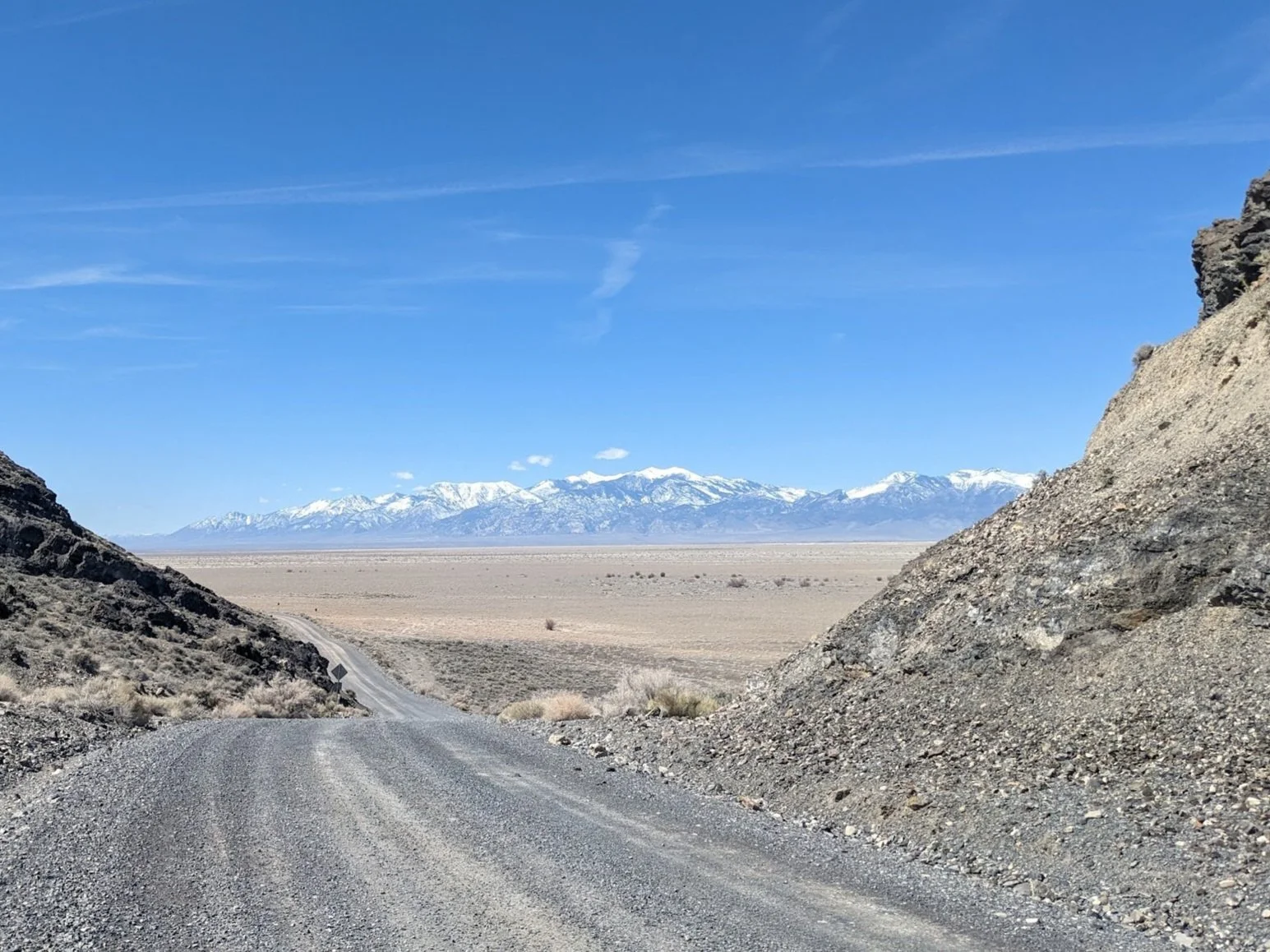
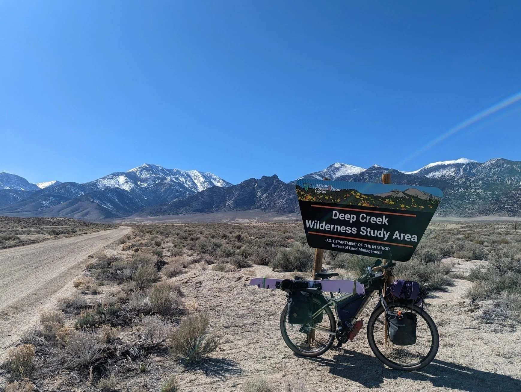
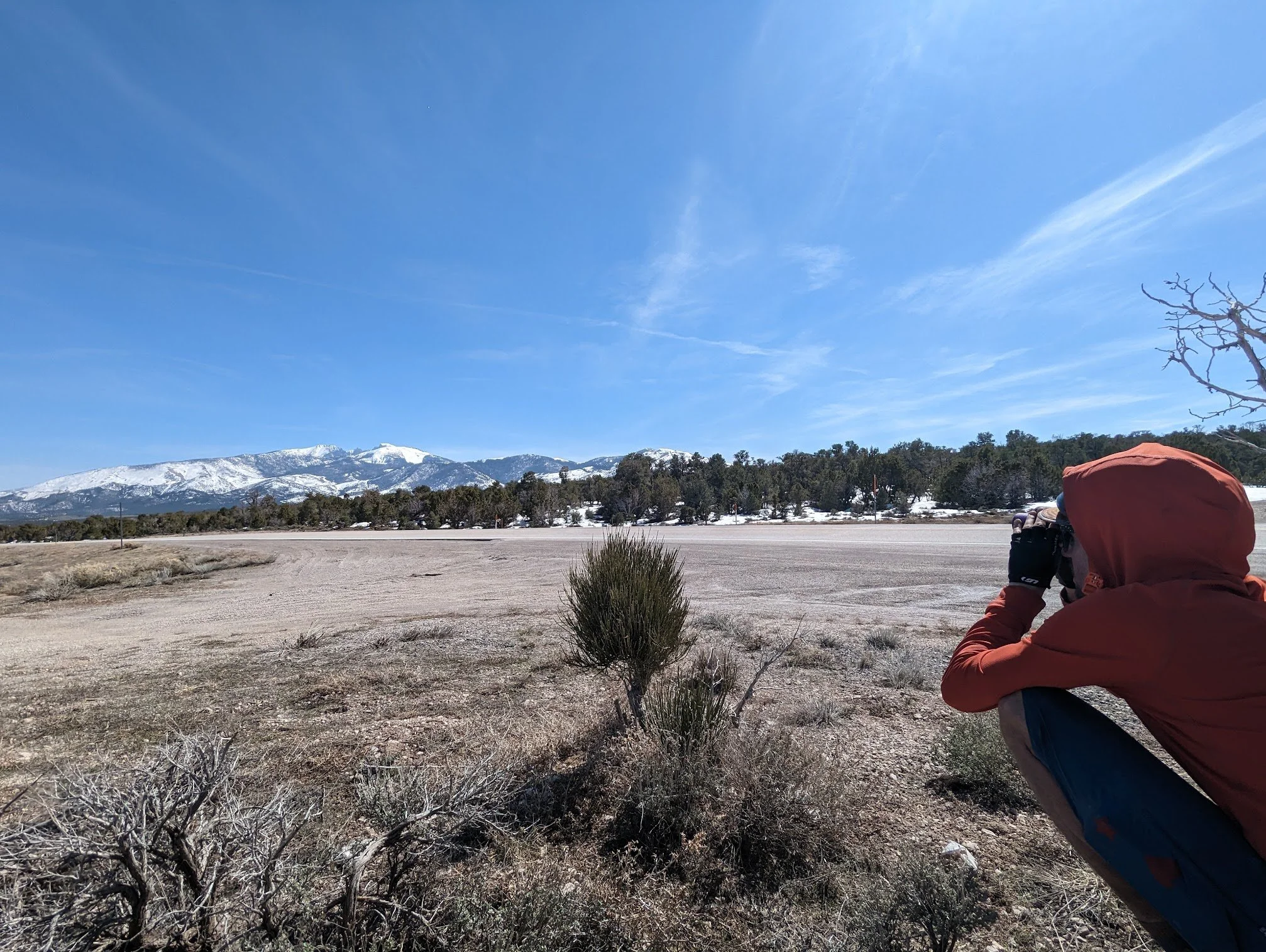
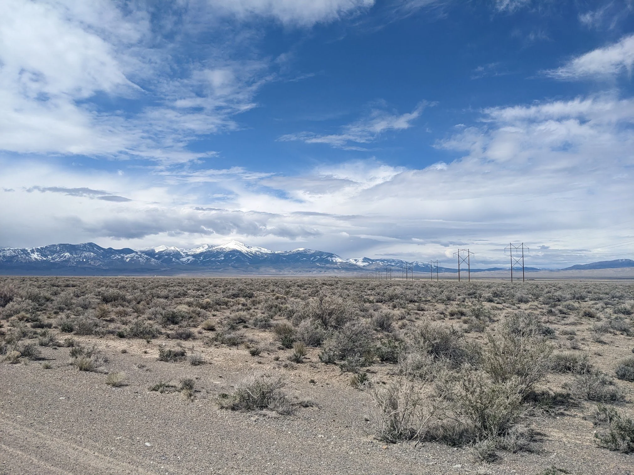
Islands in the sky. The Deep Creek RangeGetting our bearings straightThe next day brought the first real views of the Deep Creeks and we were hit with the reality that we would be on snow in less than 24 hours. We took some time at a good viewpoint to scope out and discuss which peak we would be skiing and which drainages we would use to access it. The Great Basin provides awesome vantage points from the desert floor all the way up to the big peaks that hide thousands of feet above, something I imagine is pretty unique to these islands in the sky. We continued and biked up into Granite Creek Canyon where we found a fantastic little campsite under whispering pine trees and a rushing creek. With our snow gear mostly ready and a rough plan for the day ahead, we crawled in our quilts and rested for our first shot at snow since leaving Salt Lake.
Headed into Granite CanyonThe only shade for milesRed Mountain
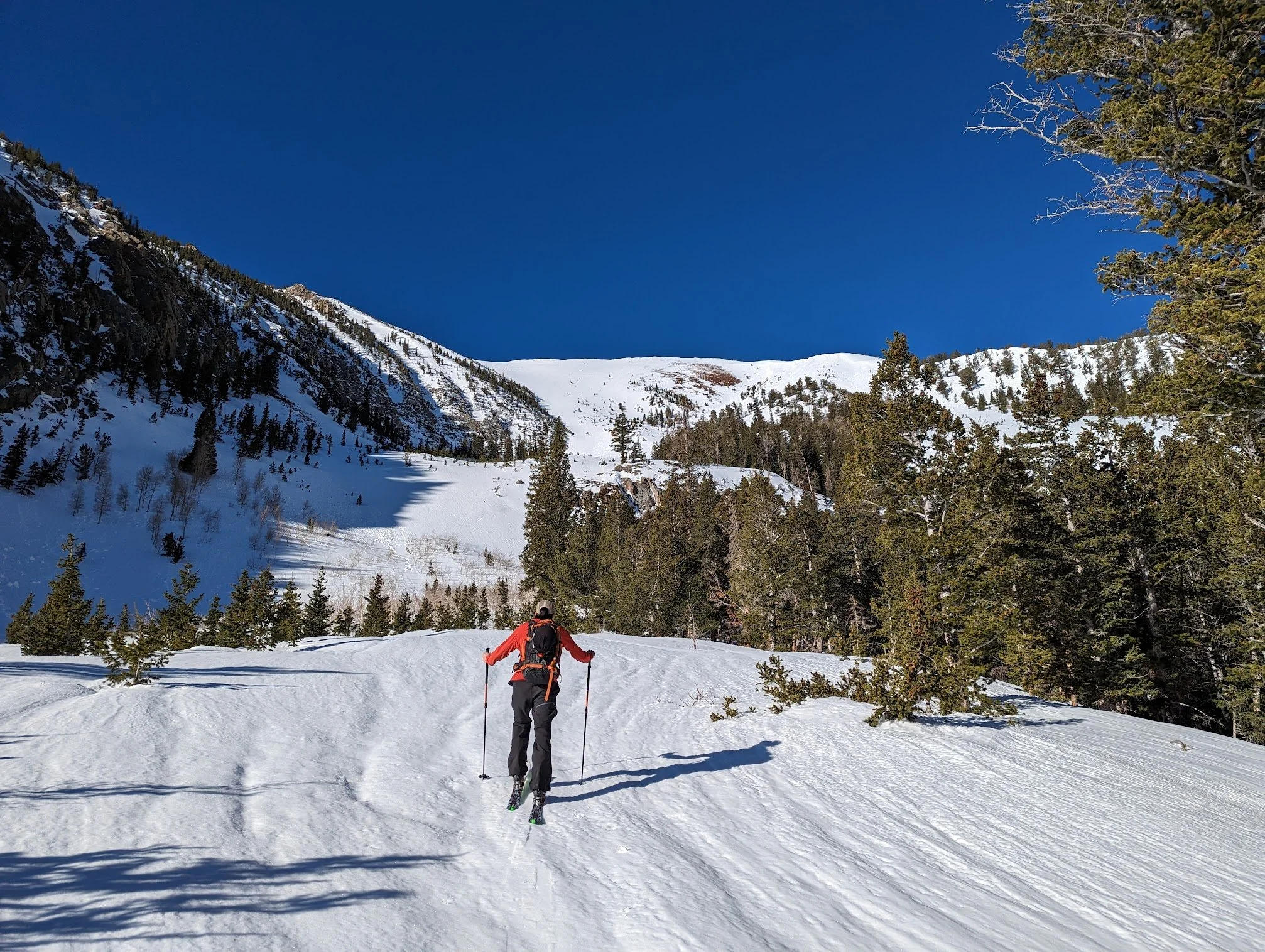
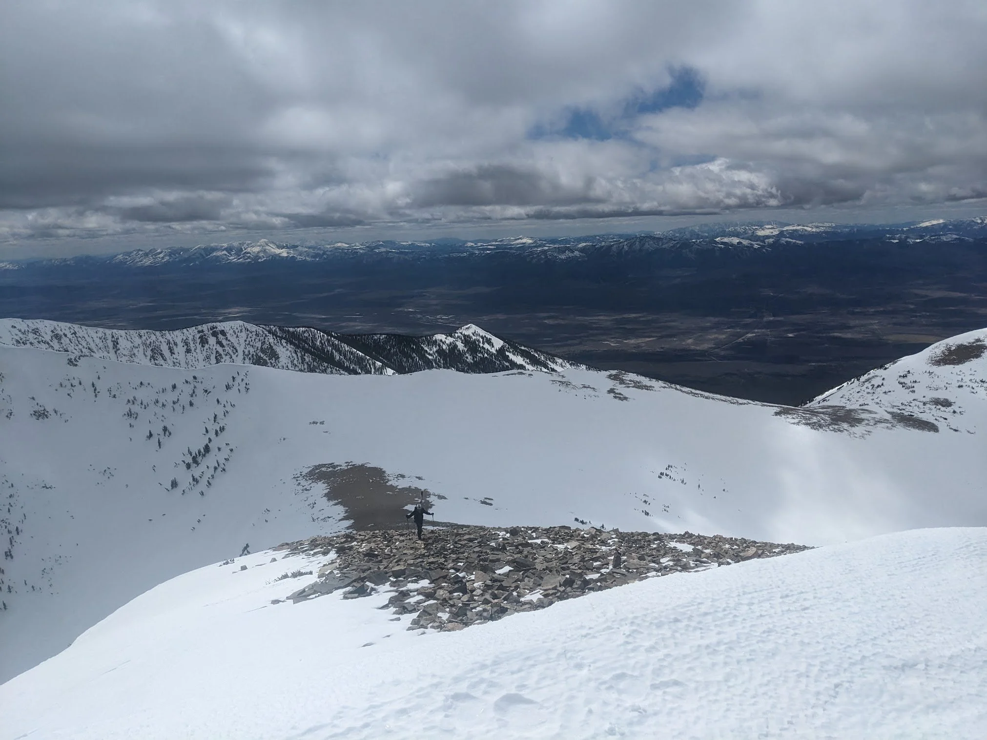
Ian on top of a record snow pack between Red Mountain and Ibapah PeakIt turned out that a leisurely 9 a.m. start was not enough time to summit these mountains that were rapidly melting during a spring heat wave. Between a few subpar navigation decisions (always take the beaten path, not the overgrown road) and a late start, we were caught in full meltdown mode before we even got above the tree line. While we were not yet in avalanche terrain, the snowpack was collapsing beneath our feet on our ascent. The snow had not yet consolidated into a real spring snowpack, and the rapid warming caused the snow to become so saturated that we could posthole to our hips, even with our skis on. We turned around just after noon as roller balls started forming on the steeper slopes ahead, doing our best to not break our legs in the crumbling snowpack on our way out. I forget which one of us said it, but if we were going to ski these mountains successfully tomorrow, we were going to have to “go hardo”, and wake up early and move fast to beat the meltdown. So that’s what we did. We enjoyed a cold plunge in the raging creek next to our camp and prepared for a more diligent mission the following day.
Red Mountain - 11,549 ftShop Rat loves mashed potatoesWith some beta on the timing and approach, we went hardo the next day and got the job done. Our alarm went off at 4:20 am and we threw on an a-framed ski pack, hoped on our bikes in sandles, pedaled to the wilderness line, hiked between cacti until consistent snow, hopped on our skins, threw on ski crampons when things got steep, and then swapped those for boot crampons when things got icy, and were at the summit ready to drop in on Red Mountain by 11 am.
Dropping in from 11,000 feet above a barren desert 6,000 feet below was a surreal feeling that we wouldn’t get used to. The turns weren’t spectacular, but exciting at the least. Something like week-old mashed potatoes. I think the splitboard enjoyed these conditions more than the skimo skis. Toward the bottom of the run and in a safe spot we managed to get some wet slough to build and turn into a bit of a wet slide. We had made it down our line without a moment to spare. We weren’t particularly proud of how close we had cut our timing to the meltdown point, just stoked to have made it successfully off the steeps. A few miles of bushwhacking, survival skiing, rock jibing, mud skimming, and we were back to the tent.
Bike exit back to tentLooking back at this day, I think we made good decisions on our route and how we moved through the terrain. We knew that warming was going to be a risk and at what time it was going to become a risk from the prior day’s observations. Although we cut it close, we were in control all the way to the bottom of our line. It was my first time experiencing warming conditions to this extent and it was a valuable experience I’ll look back on each spring.
Instead of celebrating and relaxing from a demanding day in the mountains, we felt the need to get out of the Deep Creeks. We didn’t love how the whole range felt like it was melting. We took one more cold plunge in the creek that was then flooding past the high water line, packed up our bikes, and rolled out around 6 p.m., straight into a headwind. All we could do was be excited to be back on our bikes, riding through a sunset so vivid it felt like a northern lights showing in twilight colors.
Will trade headwinds for sunsetsDeep Creeks → Schells
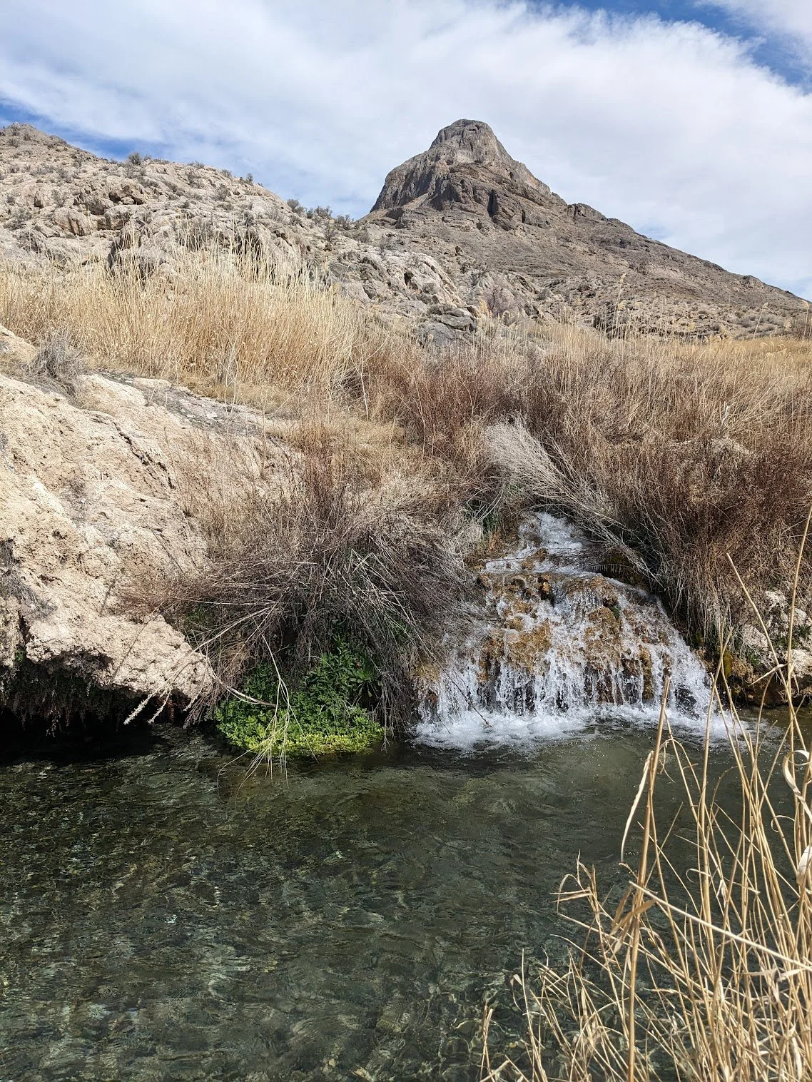
Ian headed towards the Schells via GandyWe woke up in the “town” of Gandy, surprised by our surroundings since we had rolled in under a moonless evening around midnight. Spring Mountain was towering above Gandy Warm Spring just outside our tent door - really quite the desert spectacle. We planned to take a rest day here to soak in the pool temp water, hydrate, sleep, and scavenge for some food before heading to the Schells.
Spring Mtn & Gandy Warm SpringI put “town” in parenthesis, since there’s really not much to Gandy, although I had seen on maps that there was a small ranch or something down one of the gravel roads we were camped by. I had read that they raised cattle and sold the meat as an additional offering to their overnight amenities. Since we were about halfway through our allotted food, but nearly all the way through our snacks, we thought it would be worth our time to try and find this ranch, or whatever it might be. At this point, we hadn’t had cell service since we left Vernon, and we didn’t expect any until the town of Baker in another week or so.
Bates Family RanchWe rode in circles for a bit and at the verge of giving up, a local couple out for a rip on their ATV pointed us towards a few trees in the distance, stating that property might be what we were looking for. As we rode nearer we saw signs for “Bates Family Ranch” among some small cabins and a little outdoor patio area. After a bit of snooping around what seemed to be a vacant operation, we were greeted by Jerold, the 82-year-old patriarch of the ranch. Jerold tried to give us a hard time for snooping around since his granddaughter ran the resort and it wasn’t yet open for the season. Too curious about what two young men were doing on his ranch with bicycles, he wasn’t stern for long. We explained that we rode there from Salt Lake City and we were passing through on a ski trip. This was enough to win him over. Once he was finally worn out from sharing his life story and showing us his restored army vehicle, he gave us the wifi password and welcomed us to linger around as long as we needed, and even sold us 3 pounds of frozen ground beef to keep us fueled for a few more days. No snacks, but we were grateful for anything we could add to our shrinking food bags. We took some time to charge our devices, call our moms, and check weather forecasts before heading back to our camp. It looked like our big heat wave was over, and that a cold front was on its way with some potential snow up high in about a week’s time. The wind was picking up, so we holed up inside our tent and mixed the first pound of ground beef into our Thai noodle dish. It was actually pretty bomb, and super filling. We quickly fell into food comas and dozed off listening to Jon Krakauer’s “Under The Banner of Heaven”, ready to head to the Schells the next day.
Durango just wanted new friendsThe wind persisted the following day, so we enjoyed a morning soak in the springs, hoping it would let up. It was still windy when we got out of the water, so we ate another pound of ground beef mixed into a meal. Still windy. Maybe even windier than before. Was it “really too windy to pedal?” I asked. “Definitely”, says Ian. He was right. We hated not being able to move, and even more so disliked being blasted by constant sand. We had a rule that if we couldn’t travel at a pace of at least 6 miles per hour on flat ground, we were better off resting or doing things other than pedaling. With all our camp chores done and pedaling out of question, we wrote the day off, ate the final pond of ground beef, and listened to more Krakauer as we waited for the sun to set, hoping the next day would let us escape.
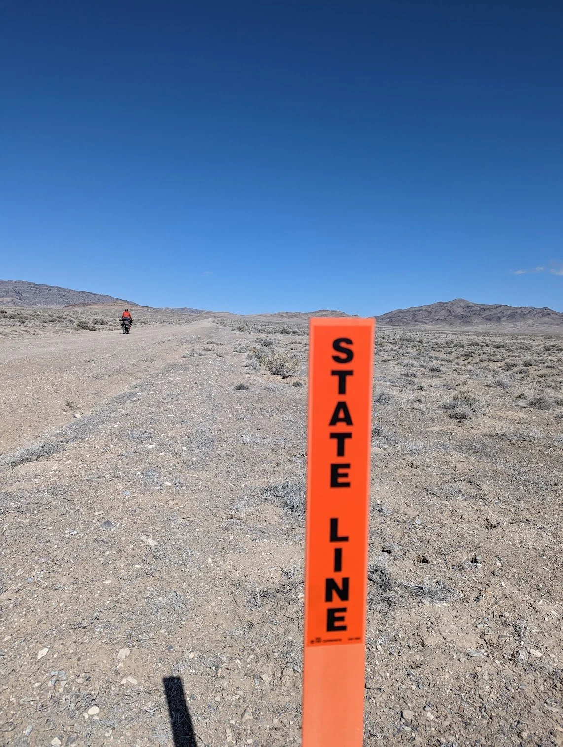
Not all borders are equal. UT/NVWe woke up to our tent thumping in the wind. It had not let up, but we weren’t going to stick around for another day of our own little Burning Man sandstorm. We packed up in what was a bone-chilling wind, turned our bikes straight into it, and pedaled toward the Schells. We crossed into Nevada early in the day, but it was still windy across the state line. We had fun listening to music together and embracing the wind as we slowly and steadily revealed the Schells. Like we did with the Deep Creeks, we took some time to identify our objective, North Schell Peak, from below. This peak seemed more straightforward, but as the morning faded to afternoon and North Schell Peak glared down on us from above, we had a moment of doubt that we’d actually be skiing that peak the next morning. We’d just had 2 rest days and didn’t want to wait another whole day before heading up there, so we committed to making it to a camp up the Bassett Creek drainage and getting another super early start the following day to beat any heat that might cause dangerous conditions.
Schells on my right. We’d ski these mountains the following morningNorth Schell Peak
Ridge walk to North Schell Peak. Not a bad view for a false summitOn the skins before sunriseI’d like to say that the Schells were more straightforward than the Deep Creeks. We definitely had a lot more going for us this time. Cooler temps, a more defined route, and a bit of experience with these Great Basin peaks made for a more successful mission. We still ended up touring 14 miles and climbing 7,000 feet that day, most of which was bushwhacking on a “trail” that was buried under snow.
Dropping!Once again we started at 4:20 a.m. and got most of our walking approach done under headlamps. No bikes this time, since we’d be crossing Bassett Creek early in the route. We had quite of bit of bushwhacking and really tricky side-hilling once on the skins. Taking the drainage and “trail” meant bushes -really mean desert bushes with thorns and things that grab you and don’t let go. Taking the sidehill meant cramp-inducing one-legged lunges with each step. We took turns leading each other through a healthy amount of both. We finally got to a spot where we a-framed our skis and strapped on crampons to climb 2,000 feet out of the drainage and up to a false summit.
Overall, North Shell Peak wasn’t as technical as Red Mountain. It was a pleasant ridge walk from the false summit to the peak and provided an awesome viewing opportunity to scope our line. Things were still firm at the top so we took our time dropping in, and then laced 2 beautiful lines right down the face of the tallest peak in the Schells. The snow was variable, as we expected with such varied temperatures leading up to that day. We still had some time before things got too warm, so we climbed out for one more run, heading north from the false summit and back down the drainage we climbed up earlier in the morning. We were gifted with some hoop-and-holler-worthy corn on this run. Finally some snow we were really psyched about. The stoke soon faded as we ollied and jibbed our way over creeks and through the dense foliage of the ravine. My sliding ended in what felt like a toeside Baldy traverse at Snowbird, except 10x longer. I was grateful for my days chasing Ian around that resort and learning how to keep up in that sort of terrain. The splitboard is a wonderful tool when wielded properly.
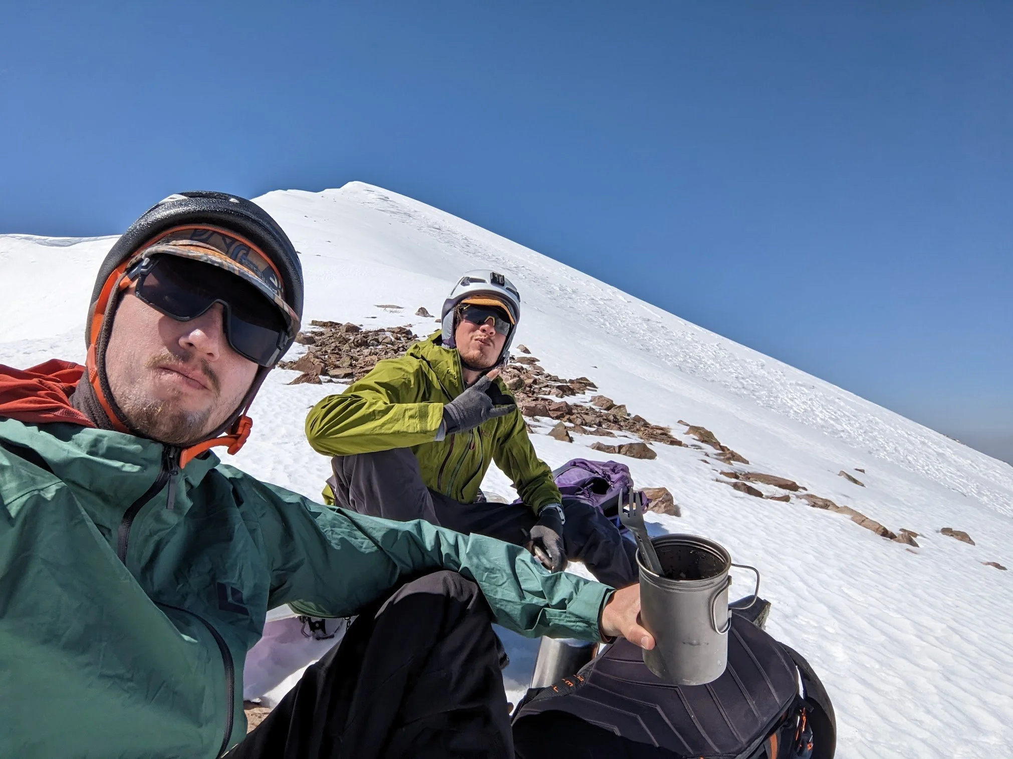
Our turns down North Schell PeakHow we look when we call moms from the summitIt’s corn!Back at camp we dried things out and enjoyed some rest. The Schells and the Deep Creeks had become Wasatch appreciation tours to us. We knew things were going to be remote and wild out here, and now we were basking in the soreness and exhaustion of how difficult it really was. We couldn’t have been more fulfilled. Another beautiful sunset took over the sky as we repacked for heading to Baker the next day. Thankfully, Great Basin National Park would provide a bit more of a tame Park experience than these rugged, remote mountains that few people know about.
Humble abode each night. Especially stoked to see it after this oneSchells → Great Basin NP
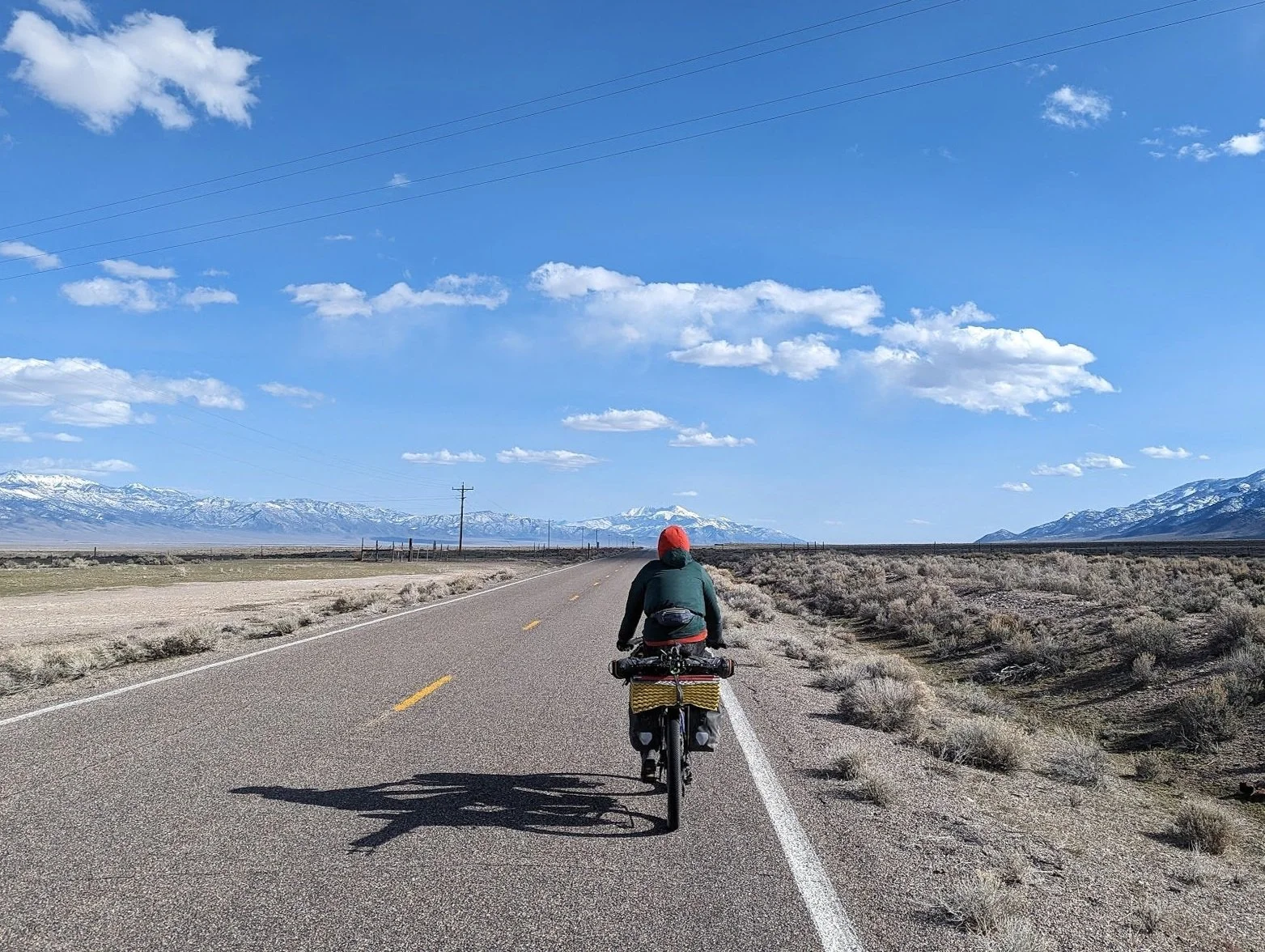
Ian pedaling head on toward Wheeler PeakOnly soul we met on this stretchScopin' from Sacramento PassOriginally, we planned to take 2 days to bike from the Schells to the town of Baker. After looking over our maps and realizing how dry it was out there, even in a high snow year, we decided we’d much rather just push all the way in one day instead of camping in the open, barren desert. That day was probably my most difficult day of pedaling on the trip. The wind was relentless, the road was washboarded, and the exhaustion of the prior day was lingering. We tried drafting each other to catch a break from the wind, but the heavy bikes paired with the variable road and abusive wind made it hard to pedal in a single-file formation for very long. We watched windmills in the distance grow larger each hour as we put one crank in front of the other, fully appreciating why there were windmills out there. As we turned east toward our final climb over Sacramento Pass, we escaped the wind and enjoyed views of our next objective: Wheeler Peak.
The descent down from Sacramento Pass to Baker could only be described as blissful. The sun was out, the wind had gone elsewhere, and we were moving faster than we had all trip. We hit 30mph and watched the final miles of the day fly by.
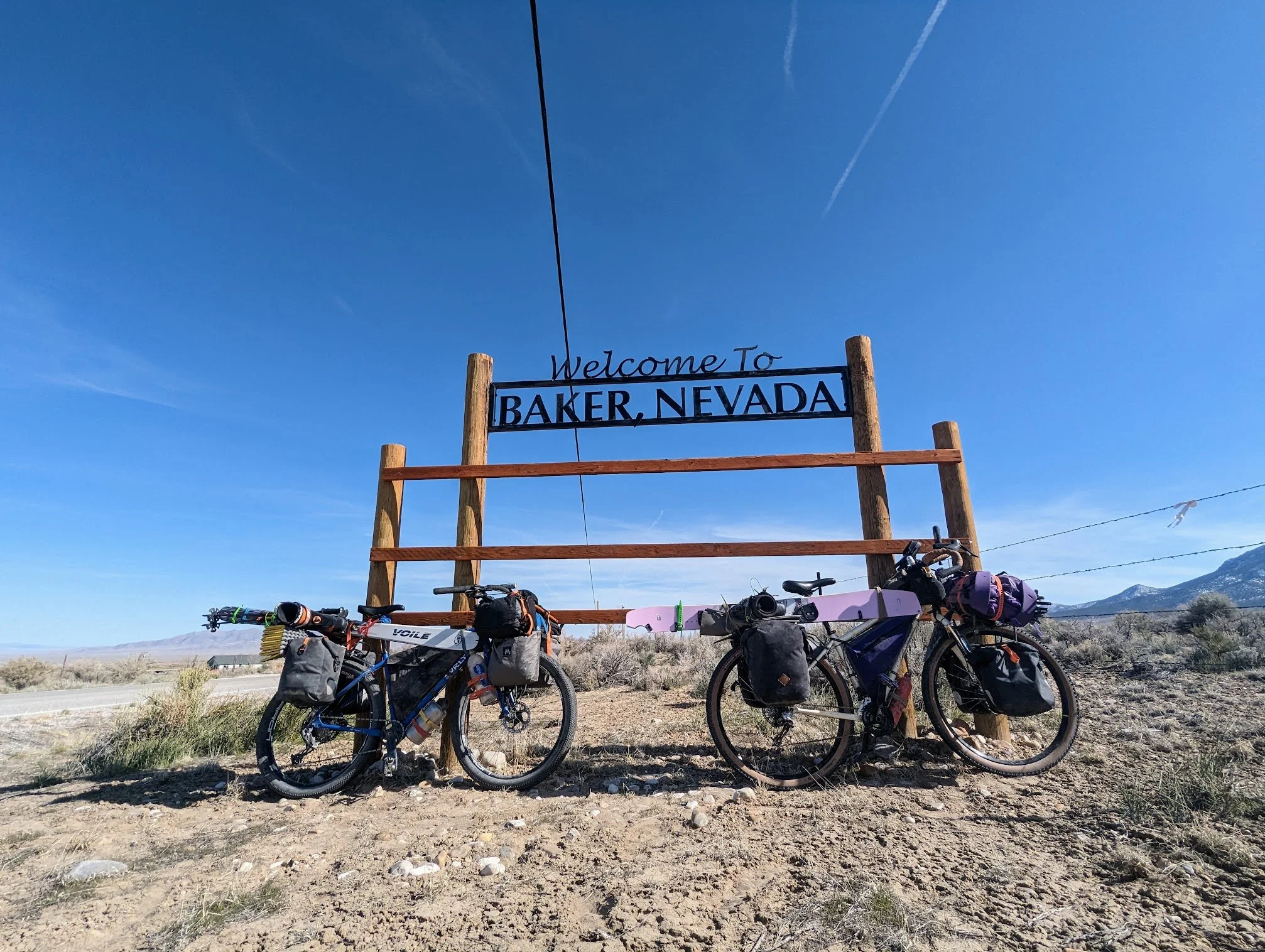
Baker, NV. A town with exactly what you need and nothing moreMeme and ice creamBaker was quiet and sleepy when we arrived that afternoon. We were definitely early for the tourism season, so we had no problem checking into the first motel we saw. The hosts, Dakota and Samantha, even gave us the “off-season” rate since we rolled in on bikes. They invited us to come back to the motel lobby, which was also the local bar, after we settled in. We ditched our gear in our room and set off on naked bikes to explore the town. After about 3 minutes we realized we had seen the entire town: the Whispering Elms Motel / Bar, the Post Office where hopefully the rest of our food was waiting, a nice looking restaurant only open on the weekends, the Startgazer Inn / Bristlecone Pine General Store, and a Mexican food truck. Not surprised but a bit disappointed, Ian and I looped back to the Bristlecone Pine General Store to check out what our shopping options were. Our disappointment with Baker was quickly thrown to the wind.
We <3 cats. Dusty doesn't <3 backWelcoming signs and decorations greeted us before we even walked through the doors of the store. The warm welcome was followed by an even warmer woman inside named Liz, the owner of the store, who was ecstatic to have visitors and to hear our story. While chatting about our recent travels and our next plans as we sifted through her collection of boutique goodies and treats. Her husband, James, was also there and equally excited to hear of our adventure. James with the superintendent for Great Basin National Park. He and Liz had worked in Parks together all across the country for most of their careers until they decided that Great Basin NP was a particularly special one that they wanted to move their life to more permanently. Their excitement was contagious. We hadn’t stepped foot in the park yet, but we knew there was something special waiting for us up there. All of the positive energy in that store made time fly. After a craft beer and some snacks, we said our goodbyes and promised to return the next day during our rest day to sort out our final plan for Wheeler Peak. One more drink at the motel bar to chat up the locals, and then we were off to bed. It felt great to snooze in a bed.
I love doing chores on down days on trips like this. There are only so many things to do, and doing them really makes a big difference when you move on. It’s like doing a bunch of little favors and preparing a bunch of gifts for my future self. I think all the luxuries of modern life make it easy to overlook these gifts for future me when I do chores in the modern world. I can let laundry stack up, I can get by on eating out, and I can scroll through my phone all day as each day blends into the next. Out there, I’m so so grateful for a clean pair of underwear and a week’s worth of meals and snacks prepared ahead of time. I’m always working to take that mentality back with me after these trips.
I started the day with some laundry, dishes, a trip to the post office to retrieve the rest of our prepared food, and reorganized my gear. We planned to move all of our overnight gear from the bikes onto our ski bags so we could camp at the base of Wheeler Peak. This meant snow camping, something neither of us had much experience with but something we were willing to try to get a good shot at the 13,000-foot peak. Once our gear was all sorted, we headed over to Liz and James for coffee and conversation. With maps spread across the store table, they shared all their favorite spots in the park and pointed out some peaks we hadn’t considered. Without too much convincing, Liz and James helped us decide that since we had biked all the way there with our splitboard and skis it would be well worth our time to venture beyond our original objectives of Wheeler and Doso Doyabi peaks. We added Pyramid Peak to our list. Since we’d have to access Pyramid Peak from a road a bit more south in the park we’d have to come back to Baker after the big peaks to resupply. Liz offered to host us in a room at the Stargazer Inn during our intermission, and James pointed out a campground closed to cars but accessible by bike to use as a base camp for Pyramid. It was all coming together quite nicely.
Made it somewhere! Pyramid Peak in the backgroundWith rested bodies and bags full of goodies from the Bristlecone Store, we set off early the next morning. Just a quick six-mile gradual climb in a sidewind that knocked us each off the road and we were at the Great Basin National Park visitor center. We’d scored a tour of the Park’s famous Lehman Caves, so we explored those after a killer breakfast burrito and cappuccino at the visitor center cafe. The cave tour guide had everyone in our group of twenty people introduce themselves. Ian and I had a fun moment stoking our egos as we dropped the fact that we had ridden our bikes there to go ski the big peaks above the caves. The caves that followed were spectacular! They reminded me of the Shasta Caverns I went to growing up visiting my grandparents in northern California. We followed up our cave tour with one final bike ride to Upper Lehman Campground at about 8,000ft. From there, we ditched the bikes and loaded our bags with everything we needed for a couple of nights out and all our snow gear. I was skeptical about how it was all going to fit, but with enough Voile straps and carabiners, we made it work.
Shout out to the folks we met at the cave tour for taking this picWheeler Peak & Doso Doyabi
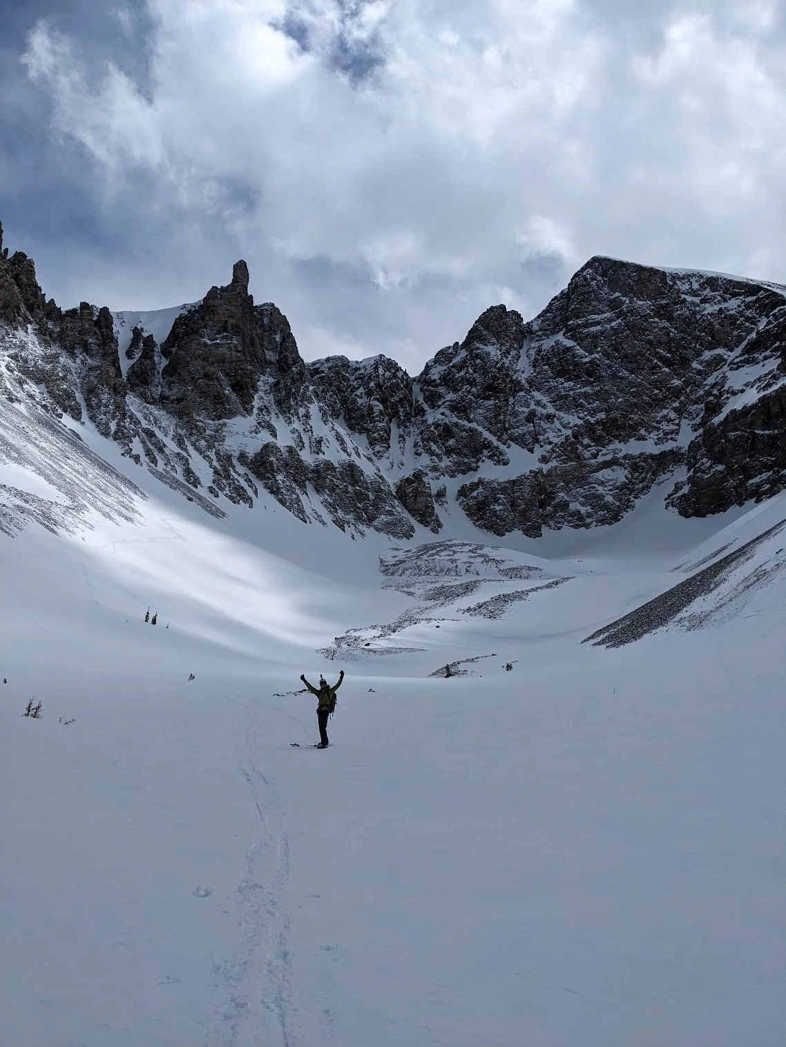
Our first glimpse. Wheeler on the right, Doso Doyabi in the middleEven with all of that gear, the 4-mile tour really was a walk in the park. We were able to stay on a defined trail the whole time, even following some old ski tracks at times. We made it to Wheeler Peak Campground in the early afternoon. With nothing but the tops of outhouses showing through the record snowpack and no idea where the proper campsites were, we set up our tent in a flat spot that would receive nice sun for the rest of the day. We were likely in the middle of the road, but there was no way to know for sure. Overhead was tomorrow’s objectives: Wheeler Peak and Doso Doyabi. We ended up burning through nearly all the rest of our fuel that night, melting snow for water and tea and cooking. It may have been the elevation of 10,000 feet, the below-freezing temperatures, a stove covered in wind-blown grit, old fuel, or a combination of things, but we had enough water to make it through the next day. We’d deal with that issue once our peaks were bagged.
Unbeatable views from the tentThe forecast we received a week earlier in Gandy that called for a chance of snow at upper elevations came through. We woke up to 2 inches of fresh snow. Our boots and everything were completely frozen, so we waited for the sun to shine down before we really started moving. Once we got going along with the day, weather conditions couldn’t have been more ideal. Sunny and cold, maybe just above freezing. Unfortunately, it wasn’t the same for the snow. The new snow provided a nice insulating layer on top of the freeze-melt cycled snow underneath, creating ideal “dust on crust” conditions. We took this into account as we toured up Wheeler. It was a relatively straightforward ascent with ski crampons and boot crampons making appearances when needed, and we reached the summit around noon.
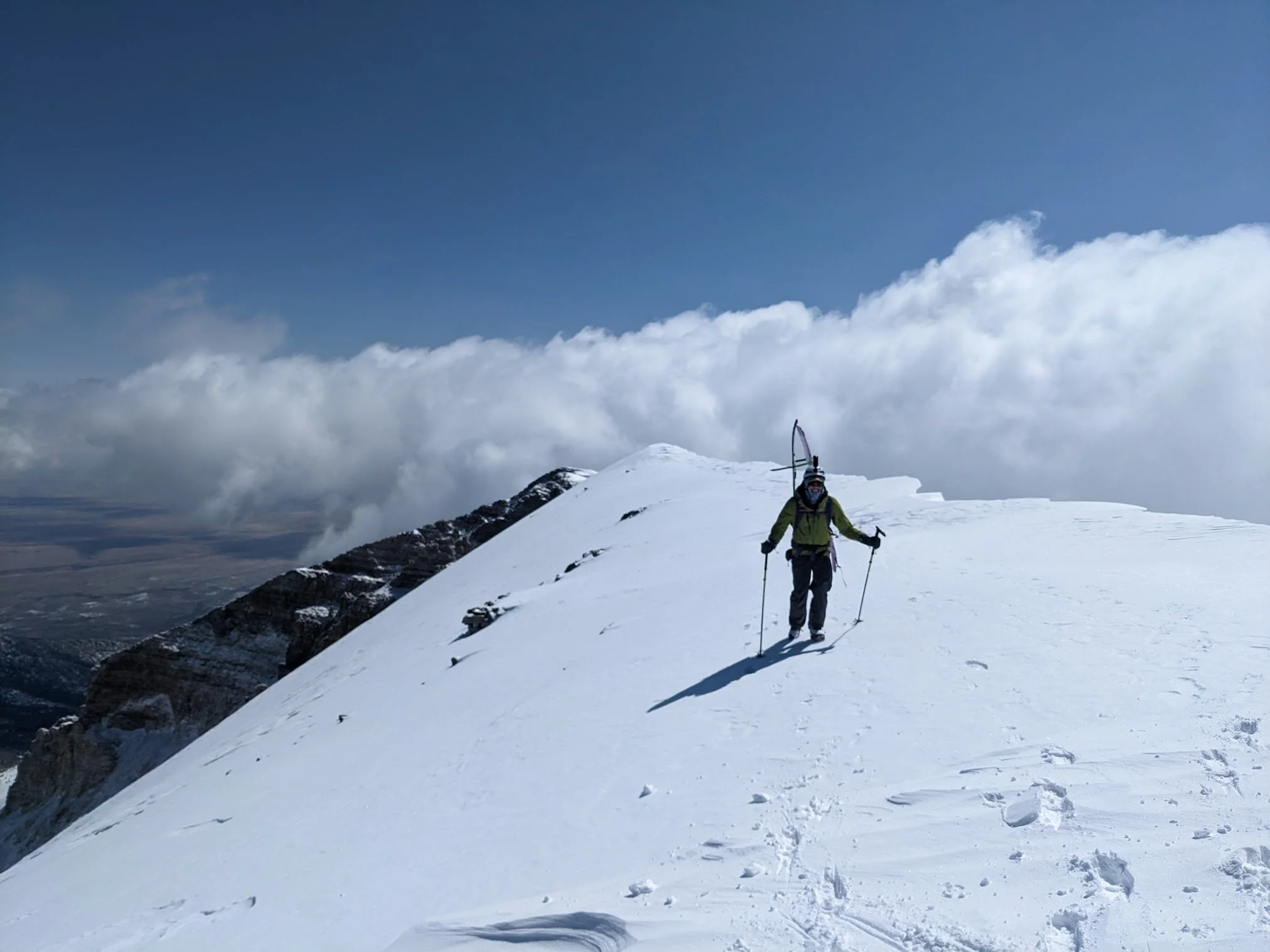
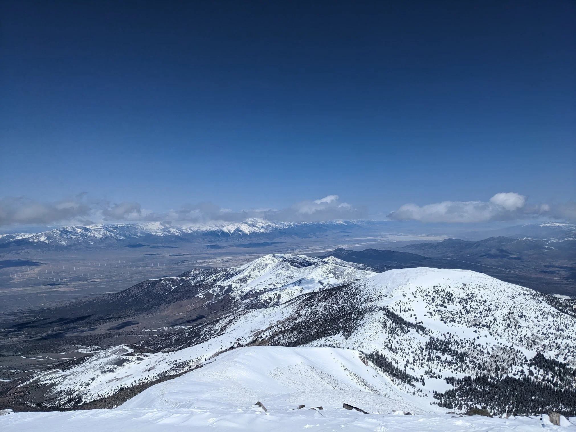
Head in the clouds on Wheeler. Couldn’t have asked for a better dayLooking south towards PyramidLooking NW toward the SchellsThe top was so wind-scoured that we down-climbed a section before we really clicked in for our descent. I think this is where Ian’s skis enjoyed the firm snow more than my splitboard. While they were some of the most picturesque turns of life, they were certainly the crunchiest of the season. We transitioned in the basin below Wheeler and Doso Doyabi on the Wheeler Peak Glacier, gearing up for one more ascent up a daunting Doso Doyabi couloir.
Looks dope. Let’s see where it goesIan dusting the crustThere were a few couloirs to choose from, so we picked the longest one and started climbing. We couldn’t see the end of it, so we could only hope it would let us top out and ski it entirely. Luckily our wishes were granted, but not without a near-vertical ice axe and crampon-demanding climb. We got to a point that Ian and I don’t spend too much time in, where one mistake would mean serious consequences. The ride down was no different. One turn at a time, scrapping the new snow off what might have been beautiful corn snow, I made our my down the spectacular couloir. I wish I could boast about how epic of a run it was, but it was really just survival riding with a bit of style. Ian followed suit.
Couldn't believe this epic place!After exchanging hi-fives and taking some time to soak up the views in the basin, we headed back to our camp. As we rushed past trees, we realized that we were riding through the Park’s famous bristlecone pine grove. These trees were thousands of years old, and this was one of the largest concentrations of them in the world. It felt like our accomplishments were being celebrated by a group of wise elders. Back at camp we quickly burned the rest of our fuel for a bit more water. This made our decision to pack up and head back to the bikes that evening.
Wheeler → Pyramid
My decision to split-ski back to the bikes was a poor one. A splitboard is a lot better as a board, but it was humbling to know I still had my skiing roots as we exited the 4 miles we came up the morning prior. Thoroughly used up, totally worn out, and definitely dehydrated, we hopped on our bikes with an a-frame and boots still on and descended to Lower Lehman Campground. Every site was taken, all of them by a van or fifth wheel. We knocked on a van with Oregon plates and asked to use their flat tent site. Not only did they welcome us to it, but they invited us to roast marshmallows over a campfire and shared their water with us. Days like that are hard to comprehend when you wake up in a snow-covered tent, shove your feet in frozen boots, put your life on the line with your best friend, remember how to ski, bike with ski boots on, all to end up making smores and sharing stories with strangers. I just don’t get many days like that normally.
Rolling into Baker with all layers onA brisk and blissful descent brought us back to Baker. We rolled in right as Liz did. She had just returned from an art fair in Ely, where she was kind enough to pick up more fuel for our stove. She brought us in to warm up over coffee and we shared photos from our epic outing. She kept calling us her heroes, but she was really our hero. We treated ourselves to some Mexican food from the truck down the street, dried out our gear in the backyard, and set ourselves to head toward Pyramid Peak the next day. From Pyramid, we’d head back down to Baker, but we wouldn’t be stopping for another night. We enjoyed it too much there, with the kind people, the slow pace of life, and Liz’s lovely backyard and cute kitties. We knew we’d get sucked back in if we lingered too long on our way back through, so we made a plan to check out the Border Inn, a motel and casino on the edge of Nevada and Utah. The idea of a buzzing casino seemed preposterous as we gazed at Pyramid Peak from the adirondack chairs behind the store.
We enjoyed ourselves so much we hardly got photos in BakerWith a final goodbye to Liz and the rest of her store, we headed towards the Park visitor center for the last time. This time the wind was more forgiving, but it still made its presence known. We turned south before the visitor center and eventually passed by a gate that closed the road to cars. With James’ blessing, we continued on to Baker Creek Campground via our two-wheeled stallions. Earlier in the trip I had told Ian I refused to hike my bike through snow on this trip. I broke my own rule at the last possible opportunity as we hiked our bikes 20 yards through shin-high snow to get to an awesome little campsite, complete with a dry and leveled tent site, a picnic table, trashcans, and an open outhouse.
Bikes taking us where cars couldn’t - around closed gatesPyramid Peak
Surfing the lichen reefThe next day, the weather matched our emotions: A bit solemn. Grey, low-hanging clouds obscured our view of the mountains from our camp and it felt like it was going to rain. After waiting around for things to burn off we decided to just go for a walk with our skis and see where we ended up. Pyramid Peak would be a cool destination, but we had a nice route through a couple of drainages that would be a satisfying tour nonetheless if we couldn’t make it up to the peak.
Our final tour of the trip started in a shrubby desert, just like our first tour in the Deep Creeks. The shrubs then caved in around us as we lost the trail, just as they had in the Schells. Then came a new scene - big, tall pine trees grew up out of the bushes with each step, engulfing us with their massive canopies. It was spectacular that we had been in a blatant desert just before, and now we found ourselves in a pine tree forest. And just as quickly as the forest grew around us, it faded to tundra-like alpine. Not much was growing up there other than bristlecone saplings and lichen. As the clouds cleared and Pyramid invited us up to its peak, we scaled scree and boulders through what felt like a coral reef, but of lichen on the rocks. Robust oranges, tropical pinks, and sour greens. I had never seen so much colorful life in such a harsh and bare landscape. At the summit, we both acknowledged why Liz and James had chosen this park to move to. Ian and I have been to some cool places, and Great Basin was standing out as one of the coolest. We soaked in our final summit surrounded by the dazzling colors at our feet, familiar peaks in the near distance, and a hot and dry desert pilgrimage beckoning us home in the background.
All downhill from hereOne final bone-rattling side slip down from the icy peak, and then we were treated to some consistent and sustained corn snow as we rode into the forest down a new drainage back to the tent. As we weaved through the trees we laughed about the terrible conditions up top. We were so close to great snow everywhere we went. We were just grateful for the good snow under us at that moment, knowing that was the game we signed up for riding our bikes out to these far-out, rugged mountains in the springtime. At that moment, we were winning the game. Our Pyramid loop was exceptionally kind to us and we were able to ride from the peak all the way back to where we had started skinning. It kind of felt like the Wasatch.
Back at camp, we packed up and hyped up our evening at the Border Inn. In the best-case scenario, we would be welcomed to a flashy casino where we’d get a biker deal on a decent room and roll big at a poker table with free drinks, winning enough pay for our entire trip, maybe even having some cash to spare. In the worst-case scenario, we’d be greeted by a woman behind a plexiglass shield as we resented paying for a cheap room and lost all our money playing slots and drinking cheap beers. Either way, we set some wild expectations as we packed our bikes to head towards the esteemed Border Inn.
Great Basin NP → SLC
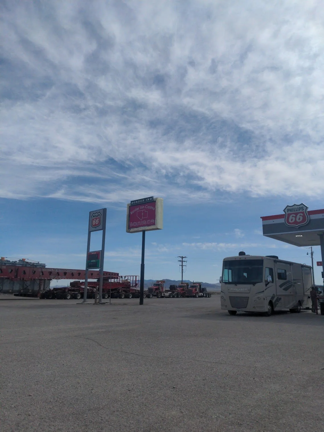
Final views of Great Basin National ParkThe notorious Border InnI’m not sure where reality landed among our expectations when we rolled into the Border Inn that night. The woman behind a plexiglass window was fulfilled like a prophecy, but she had no deals for bikers and wanted more for a one-queen bedroom than the quaint, clean, and spacious rooms at the Stargazer Inn. They only had tall boy Bud Lights available for individual beer options, and the slots looked more depressed and broken than the people playing them. So, instead of trying our luck, we cut our losses and each drank a Bug Light as we cooked a meal on a picnic table out front. We then pitched our tent in a flat spot across the highway and fell asleep with earplugs in while the flash of the Border Inn’s billboard lit up our tent walls.
After a cheap pancake breakfast and losing $6 to slot machines that didn’t even work, we leached 15 liters of water from the RV spigots and began our long pedal east. Our landmark for that first day was Notch Peak, the second largest cliff face in the US after Half Dome. All day a rain storm swirled around us and once we couldn’t outrun it any longer we set up our tent in record time, right before it really started to pour.
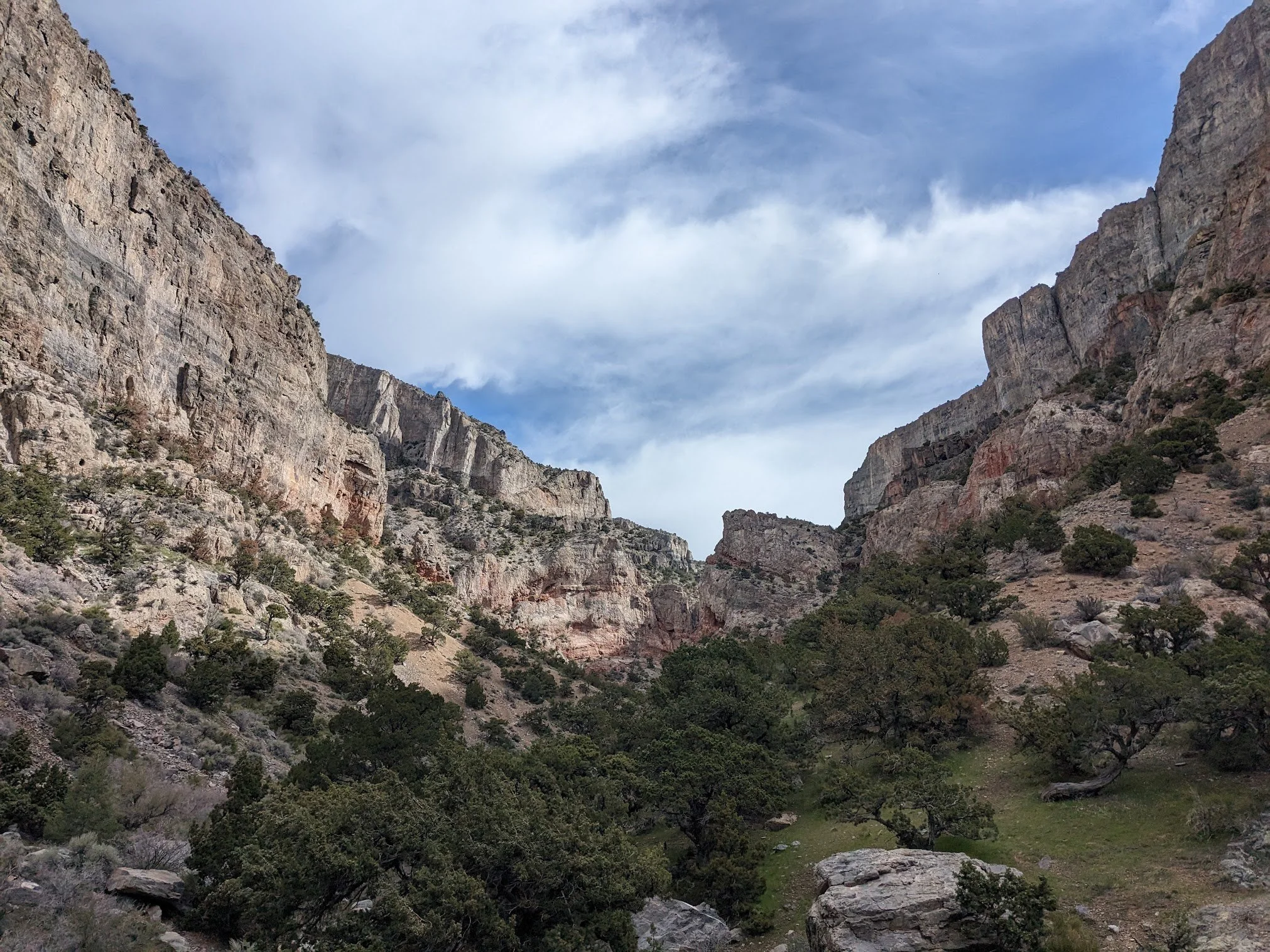
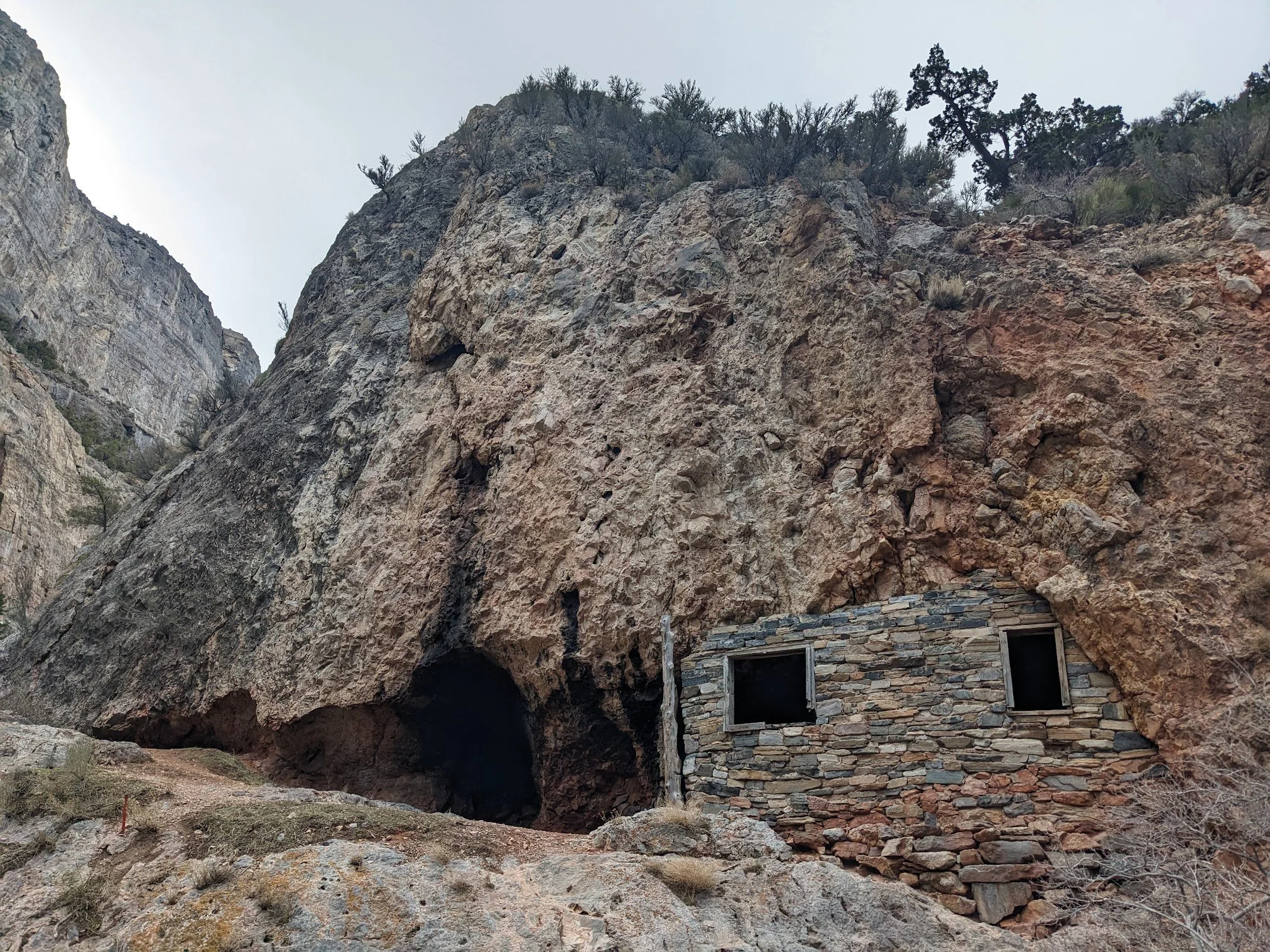
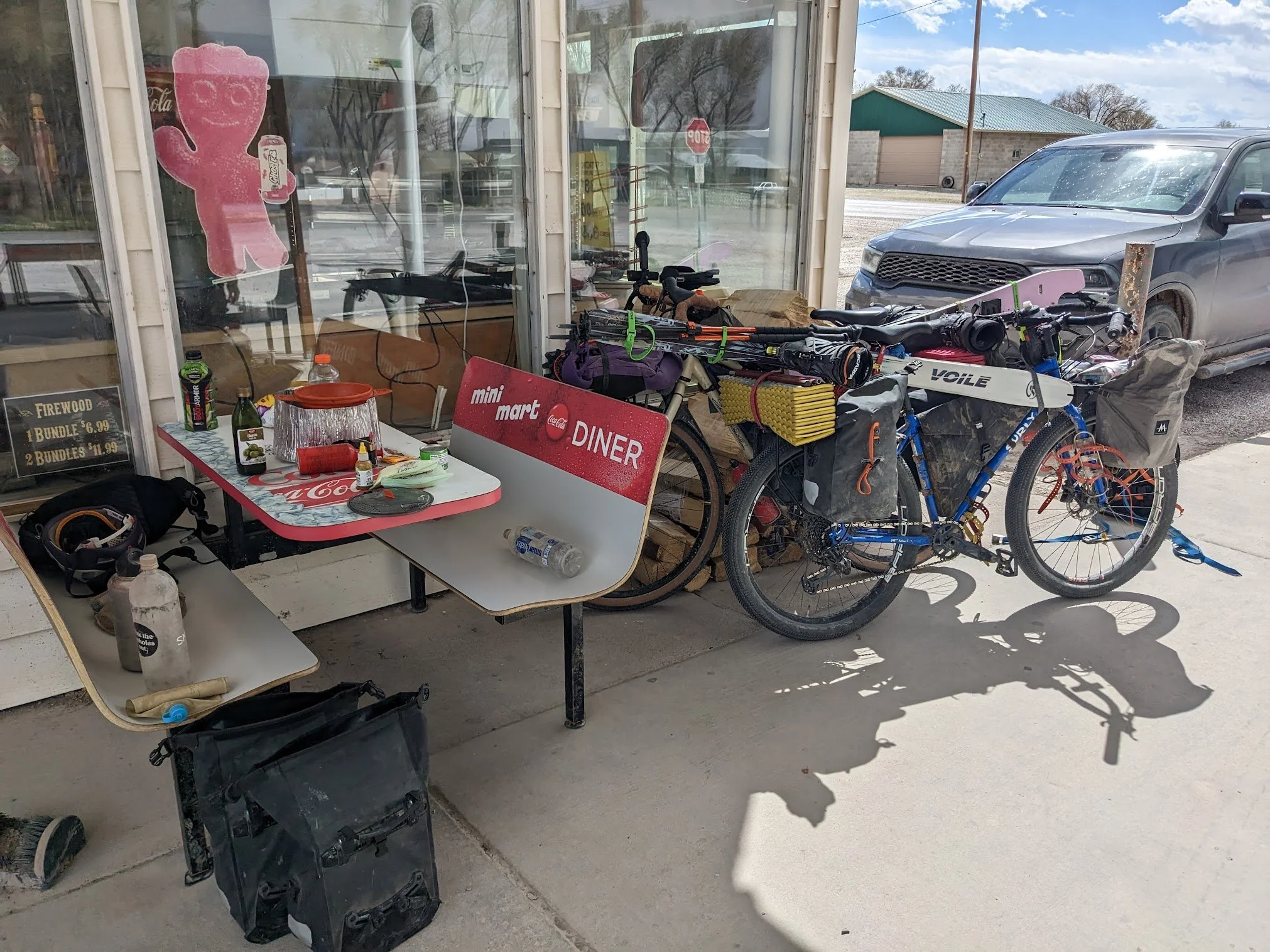
Marjum CanyonHermit's CabinCrackhead lunch break in HinkleyThe next day was crisp and clear. The salt flats in the distance reflected with flooded puddles from the night’s rain. The cool temps were welcomed as we climbed through Marjum Canyon. Along the way, we stopped to check out an old hermit cabin. Apparently, some guy used to live there and raise chickens and goats in the tight and beautiful canyon, where he’d trade the animals for other goods with travelers passing through. From the top of Marjum Pass, we could see the infamous and massive power plant all the way in the town of Delta. Between us and that power plant was our entire day’s worth of riding. We pedaled for what seemed like an entirety on a straight and ever so slightly downhill road. It felt like we weren’t going anywhere with that enormous power plant always looming in the distance. Eventually, we made it to the town of Hinkley where we stopped at the first and only store in town, the Hinkley Station. Just in time, as another big rain spout opened up as soon as we arrived. After cooking lunch and chatting with the friendly locals, we set off into the worst headwind yet. We certainly weren’t hitting our 6mph, but we had no business and nowhere to go in the rural ranching town. Plus, only 25 more miles and we’d be at Baker Hot Springs. We made it to the hot springs at sunset and enjoyed a lengthy soak that surely made our butt calluses really soft. We’d find that out the hard way the following day.
The headwind that motivated us to pedal hard to get to the hot springs only lingered the next day. We filtered water from the cold pipe pouring into the hot spring, but it tasted saline and weird. I’m not one to be picky about water, but I had a hard time putting that stuff down. It tasted like it might have been doing us more harm than good, so we packed up in hopes that the wind would die down and we’d be able to pedal to Simpson Springs Campground on the Pony Express, hoping that the water there would be turned on this time. The whole day was built around hope, and those hopes dwindled when we hadn’t even made it 20 miles into our 45-mile day by the early afternoon. We pulled off the road to debate our options. The mountains in the distance had snow on them, and it was a relatively warm day, so we started looking at routes that would take us into the unknown mountains in hopes of water. Each day only a handful of cars would pass us, but right as we were about to set off a truck rolled up and stopped, asking if we needed anything. We set our egos aside and asked if they had any water to spare. By good graces, they had a pack of plastic water bottles in the back. They handed us a few and suggested that we stop at their community center just 5 miles ahead. I had seen some gridded roads on the map and wondered what that was about. Now we knew it was an off-the-grid self-reliant community, and we knew it had water, and we had an invitation to stay there.
Ian and I had just finished listening to “Under the Banner of Heaven: A Story of Violent Faith”, a true story about crimes committed by Latter Day Saint Fundamentalist and rogue religious prophets, most of which took place in far-out communities in Utah, so we put our guard up as we rolled into this remote community, way out in the west desert hills of Utah. It turned out it wasn’t a religious cult at all. It was Operation Self Reliance Utah (OSR), where $35,000 gets you 6 acres of land, water rights, access to community assets like a gravel pit and a heard of sheep and cattle, and all you have to do is have an orchard, a greenhouse, and a small structure to make your estate legit with the country. The Welcome Center was a large mobile home unit with a kitchen and living space, a shower, and a water spigot out front. It was all we needed, but the Starlink wifi was a nice bonus as well. We pitched our tent on the front lawn and chatted with the noble folks who decided that modern homesteading beat the rat race life they had left behind. Everyone was really normal and inspiring. It wasn’t until we were leaving the next day, when I wished them well and stated how I couldn’t wait to return in a few years to check on their progress when one man asked: “You think you got that long?” He was referring to the timeline until China or Russia nukes the US. He gave us 2 years until they hit Hill Air Force Base in Ogden, UT, and recommended that we stock up on supplements to help protect our thyroids, and to always have 10 days of food stocked up, and to keep riding bikes since gas supply will be limited. Don’t worry, sir, we’ll definitely take your advice on that last part.
Big white sheepdogs from the community sheep heard did their job and barked and growled and scared the shit out of us all the way back to the Pony Express road. We were doubling back on the tracks that sent us to Nevada weeks earlier, now just a day away from sleeping in our beds at home. The road seemed more washboarded heading East, but maybe we were just a bit more tired and banged up this time. Once again out of snacks, we hyped up our return to the Silver Sage gas station in Vernon, only to find it closed. We cooked our final meals on the picnic table out front and planned an early start the next day so we could get some food in Eagle Mountain to finish things out. As we packed up, the store owner, Brian, came around the corner and apologized for not being open to cook us a burger. He didn’t feel like working that day, but he opened up the store for us to sell us some snacks and said the next time we rolled through on bikes, he’d make us a burger on him. I’m going to take you up on that, Brian.
Rolling back to familiar peaksOur final day started similar to all the rest- just pedaling heavy bikes through the Great Basin desert. Familiar peaks started popping up in the distance with a little less snow than when we last saw them. Still a shocking amount of snow for May. We stopped and got burritos in Eagle Mountain, taking them to go for the train ride back to Salt Lake. On the Jordan River Trail, a man on a road bike rolled next to us, looked our rigs up and down, and stated that it would have been cooler if we weren’t on e-bikes before he pedaled out of sight. It was good to see fellow cyclists again.
Once off the train at Salt Lake Central, we dodged cars and pedestrians through the streets of downtown SLC. Everything in the city seemed to be noisier and faster and stinkier than we remembered it. Especially the cars. With a quick stop at Fisher Brewery for some to-go celebratory beers and a quick rip on the bike path that normally takes us home from work we were back at our little red brick house. Nobody was there to greet us or celebrate our accomplishments. There were no fireworks or welcome home signs. Not even our cat, whom we’d laughed about so many times while away. The city and highway hummed in the silence of our arrival like we hadn’t missed a thing. We drank our beers on the porch, catching a lovely sunset over the Oquirrh mountains. Unlike every other porch beer before, for the first time, we could gaze out to those mountains knowing the treasures that lay hidden behind.
All good trips end with dirty gear thrown all over the lawnPost
The final route, rode counter clockwiseI’m writing this all in September, 4 months since we finished this trip. Those couple weeks in the West Desert were the most challenging and rewarding weeks of any of my adventures to date.
I think the most challenging part of all of it was the constant decision-making. There was no script on how any of it was going to look. We’d done our research and planned rough routes, but until we were actually in those canyons and on those mountains we didn’t know what any of it was going to look like. Unlike my experience on the PCT, we had no idea where we’d find a flat camp spot, where we’d find good water, or what services we might encounter along the way. We just had to rely on the facts we had, our instincts, prior experience, and oftentimes good faith that things would work out. We were never handed situations that we felt ill-prepared for or anything that felt out of control. The only wake-up call we had was when the Deep Creeks were in meltdown mode, and there was a lot to learn from the two days we spent in those mountains. As for running out of water at Baker Hot Springs, we probably could have drank the saline water if it came down to it. It was just really foul. Every moment it felt like we had decisions to make, and I think we made pretty good ones.
The most rewarding part of the trip was when we’d get to the summit and realize we rode our bikes there. Not only was scaling each mountain a feat, but we rode our bikes from our house to the base of each mountain! Out there, the bike was more than just a mode of transportation. After it was unloaded at camp, it became a tool to climb the mountains just as much as the splitboard or the ice axe. In Baker, they became a source of entertainment, riding them around on the pavement between errands. It’s a funny thing on these bike trips when the bikes take on their own persona. They have character, they act up sometimes, but they always come through when you need them the most. The bikes did fantastic on this trip carrying such heavy loads through all sorts of terrain without any mechanical issues. Shout out to the bikes, we couldn’t have done it without you.
And while I’m on a kick shouting out the inanimate bikes, there are some alive and deserving behind-the-scenes players that we couldn’t have done it without whom I’d like to thank.
The first goes to our parents and families, for raising us with such a spirit for adventure, and for encouraging us to chase our dreams on bikes and in the mountains instead of drowning in the hum of the city. You are the tailwind of all our efforts.
Another thanks to our friends who push us and teach us every day at home. Whether you’re getting up at 4:20 a.m. to meet for a winter dawn patrol, teaching us about bikes and gear in the shops, or firing up the excitement for our trips, you build us up in each moment spent with you and we look forward to more of those moments.
A special shoutout to our roommate and fellow beast, Colin, for dealing with our food package dilemma after they were routed to Vegas and rerouted back to Salt Lake. And for being our wrangler at home while we’re out playing in the field. I don’t know what we’d do without you if you fulfilled our dreams and joined us out there on the bikes ;)
Thanks to the few people we met along the way. I think we went 5 or 6 days without seeing another person at one point. The interactions with the few of you were integral to our success and sanity. In order of appearance: Brian from the Silver Sage, Damian from Simpson Springs, Jerold from Bates Family Ranch, Samantha and Dakota from Whispering Elms Motel, Liz and James from the Stargazer Inn, Brian from Hinkley Station, the Knights from OSR, and anyone else I may have missed.
And a huge shoutout to the ones who provided shred sticks under our feet for this trip: Chimera Splitboards and Voile Skis. Chimera is a board shaper and maker local to SLC. I bugged them to try all their shapes this winter and ended up finding the most fun board I’d ever ridden, the Shop Rat. It’s short and light and capable in all conditions and I knew it would be great strapped on a bike. And most importantly, it would be fun when not on the bike. Its soft flex made it maneuverable through bushwhacks and made jibbing creeks and logs more fun than a chore. When exiting our last run on Pyramid, I was still having fun buttering the snow banks and frozen puddles all the way to the end of the road. Just like a good bike, a good splitboard is a tool when you need it to be and fun 100% of the time. It held up so well that I haven’t fully tuned it up since being back - there wasn’t much more to fix than some chewed-up edges. As for Ian, he liked his skis. He constantly wished he was on a splitboard, but he looked good and had fun on them. Thanks, Voile. You make great straps too.
And thanks to anyone who read this far. It feels great to finally be able to share this adventure with the world, and you’re now a part of it. Let me know what you think and if you have any suggestions for my future writing. I hope this is the first of many.
Much love.
- Brodie

